Day 30:
Day 30: The trail is only a finite number of miles. Yesterday (Sunday) was the big one, the day I was most looking forward to: crossing the Cairngorms via the Lairig Gru pass. I knew it would take a long time so I set my alarm for 05:30 and obeyed it possibly to the disgruntlement of nearby campers at Blair Atholl castle camp site. Pack away gear, force down a sandwich and half a bottle of coke, fix up some supplement shakes and armour my feet with gel toe protectors and duck tape. Off at 06:45. Over the bridge; a couple of attempts at finding the start of the trail, and then up into the hills. The landscape changed from forest track to foothills to hillside trail to ford, working its way up heather-clad Glen Tilt (which filled an entire o/s map) to the falls of Tarf, then on to a boggy plain and a long stone track criss-crossing river and stream to Geldie Burn. Here I had my first sight of Devil's Point a 1000 metre razor's edge of black rock commanding the valley of Glen Dee. It took me 8 hours to reach that point. Then I worked my way up the Glen, slowed more and more by boggy path, boulders and terrain I had to haul myself across. This was a barren, dangerous place and a mean kind of beauty. I wasted precious minutes watching the rescue helicopter scouting the peaks looking for someone in trouble. Then very slowly I climbed the Lairig Gru pass that quickly degenerated into a boulder field where every step must land with pin point accuracy or risk a twist or break. I knew I was at the top when the river started to flow in the opposite direction. I made it off by night fall, 14 hours 25 minutes and 36 or 7 miles later, in Aviemore. I loved it but it worried me. Maybe it was not a good place for solo walkers. Glad I didn't have to spend the night up there.
DAY 31
 |
| Up the trail from Blair Atholl towards the firing range. |
 |
| Big sky country. |
 |
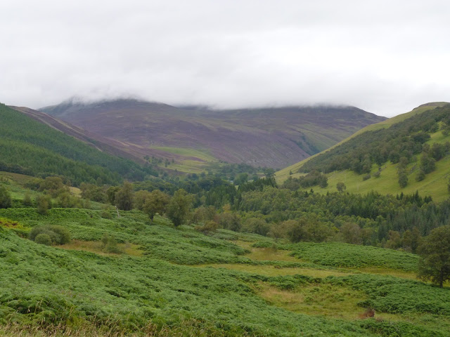
| The Grampians. |
 |
| The Falls of Tarf. |
 |
| Geldie Burn, towards White Bridge. |
 |
| First sight of Glen Dee. |
 |
| The Devil's Point, one kilometer high. |
 |
| Corrour Bothy. |
 |
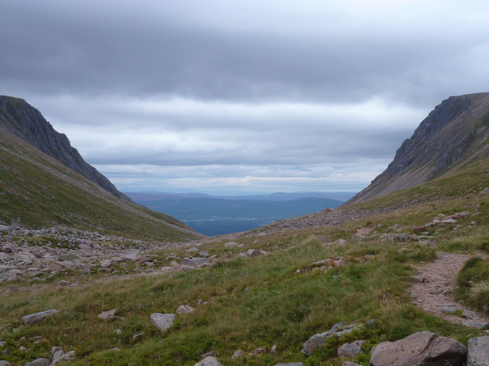
| Lairig Gru. |
 |
| Boulder field. |
 |
| First sight of Aviemore. |
A note about the blog
I must be the only LEJOGer without a smart phone. This means I don't have the ability to update this blog when I'm on the trail. My support team back home kindly offered to update the blog for me, so this will be communicated by text message and written up on my behalf. It will therefore be brief and without photos. I will expand on this when I get back from my journal entries, dictaphone recordings and photo journal. The detailed account will be published as a book which will be available on Amazon.
Charity
Thank you to everyone who has made a donation to
Helping Hands for the Blind, a respectable local charity. You can make a donation
here. Using Gift Aid, the charity is able to claim an additional percentage of each donation from the government as part of the
Gift Aid scheme.
While I am not tracking how much has been raised, the charity themselves may wish to do that; leaving a note with your donation such as "LEJOG" will help them do that. To be frank, it's more important that they receive donations than it is for me to take credit; they're actually doing something important whereas I am going on what could be described as a holiday.
My books
Lastly and leastly, I am an independent author. Writing is a pleasure even if reading it isn't! I will write an account of my LEJOG journey in the form of a book which hopefully will encourage other people to give LEJOG a try (and probably discourage many more). If you want a copy, the first batch will be given free of charge. Ask and you shall receive...
My other books are available on Amazon:


Comments
Post a Comment